About Project
Project Background
Road No. 68 (NR68) has a total distance of approximately 120 kilometers, consisting of (1) starting point at kilometers 365+700, intersecting with Road No. 6, heading north to the Thai-Cambodian border at the Chong Chom border checkpoint. Kap Choeng District, Surin Province and O samch border checkpoint, Samraong District, Udon Meanchey Province and (2) Road No. PR2SR46 (old starting point NR68) at km. 364+900 from Road No. 6 to the intersection with Road No. 68 at km. 03+100, distance Approximately 4.30 kilometers, travel time approximately 2.5-3.0 hours. The aforementioned road is an important road connecting Thailand and Cambodia. To facilitate travel, transportation of goods and services as well as resulting in the development of tourist routes. and trade along the border of the two countries to be more efficient as well as causing the prostitution of communities along the route
The Cambodian government places greater importance on building connections with countries within the sub-region, making Road No. 68, a factor in economic development through building physical connectivity, receive the attention of the Cambodian government. Therefore, a formal request was sent to the Office of Economic Development Cooperation with neighboring countries. (Public Organization) to consider providing technical assistance (TA) in studying the feasibility and designing details of the project to improve Road No. 68, Chong Chom/O samach-Samraong-Klaranh. Kingdom of Cambodia (NR68 Project) between 5-6 January 2023, NEDA has therefore sent a team to initially survey the potential of the project in Siem Reap Province and Oddar Meanchey Province to survey the route and the surrounding environment. together with the Cambodian side To meet and evaluate the current condition of Road No. 68. It was found that the Cambodian government has allocated budget to maintain the road and repair damage to the road in a ready-to-use condition. But because the road has been in use for more than 10 years, it is currently damaged. and the efficiency of the material decreases This causes dangerous spots (Blackspots) and damaged spots (Soft spots) to be found along the route. and need to adjust the road alignment (Re-alignment) Improve the drainage system and drainage pipes. and install road protection furniture to increase safety, such as guard rails and clear traffic signs. reflective pins and electrical lighting system in the common area Intersection and community as well as expanding roads in community areas and reducing road slopes. So that trucks can signal more conveniently.
Project objectives
- Survey and design project details such as roads, bridges, Access Roads, intersections, drainage systems, traffic lights, traffic signs, lighting systems on NR68 Road and Road No. PR2SR46 (the starting point of the old NR68) at kilometers 364+900 from Road No. 6 intersects with Road No. 68 at kilometer 03+100, total distance approximately 120 Kilometers.
- Study the feasibility of the project. (Engineering Economy and Society Environmental impact, Human rights impacts, Project benefits and project impacts)
- Prepare an estimate of construction costs. and prepare survey documents for bidding and selection Construction operators and documents for selecting consultants (construction control).


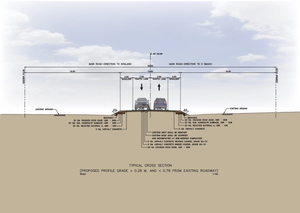
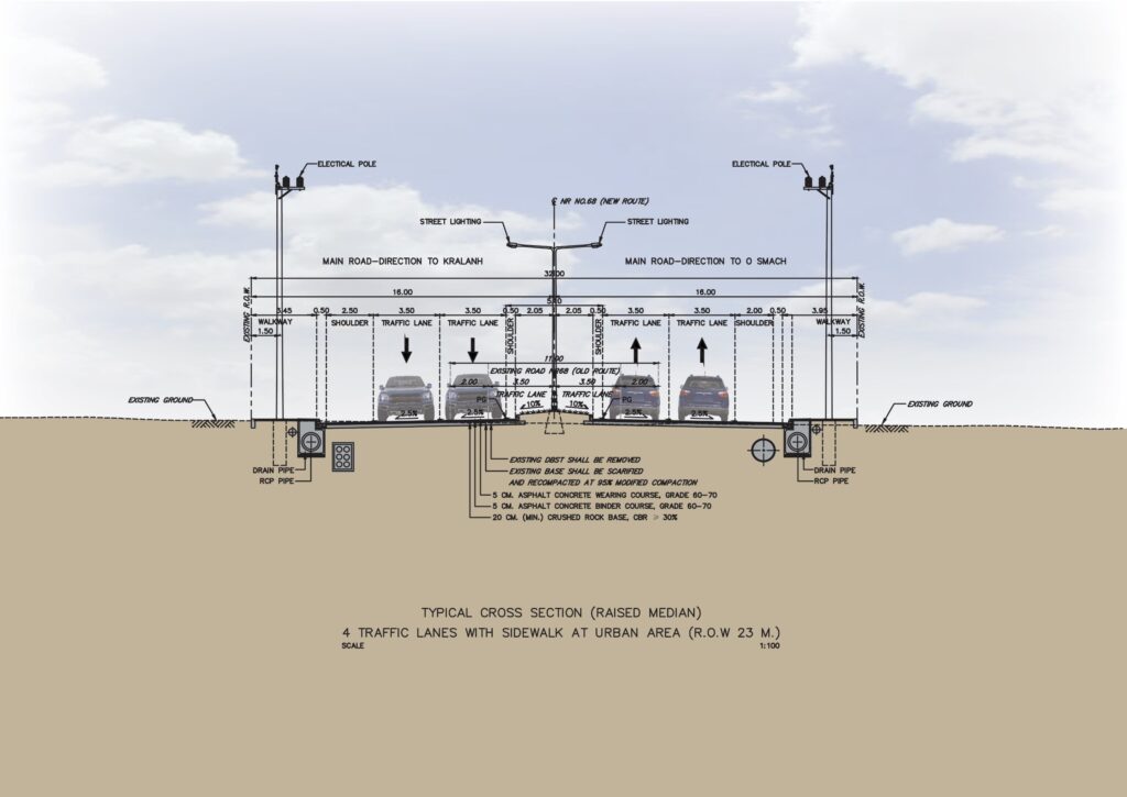
Typical Cross Section

NR68 Old Route


